My blog about walking 300km across the North of England along Alfred Wainwright‘s Coast to Coast route.

Day 0 – June 9th 2024
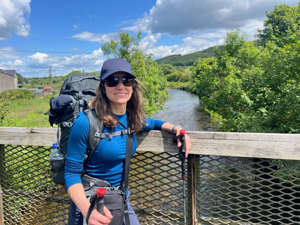
We couldn‘t wait to get started. For a few months, my wife Ariane and I had been planning this walk. It‘s a hilly 300km trek along sometimes remote trails from St Bees on the West coast of England to Robin Hood‘s Bay on the East coast. We were going to camp and carry all our own gear and reckoned we would need 12 days (the number of sections in Wainwright’s book from the early 1970s). In the run up to our departure we had read lots of stuff about the walk and how to prepare for long-distance trails in general. Ariane had even been to a talk by Christine Thürmer (a famous long-distance „thru-hiker“ from Germany) and brought back some handy tips on what to take and, more importantly, what to leave behind in order to keep the weight down.
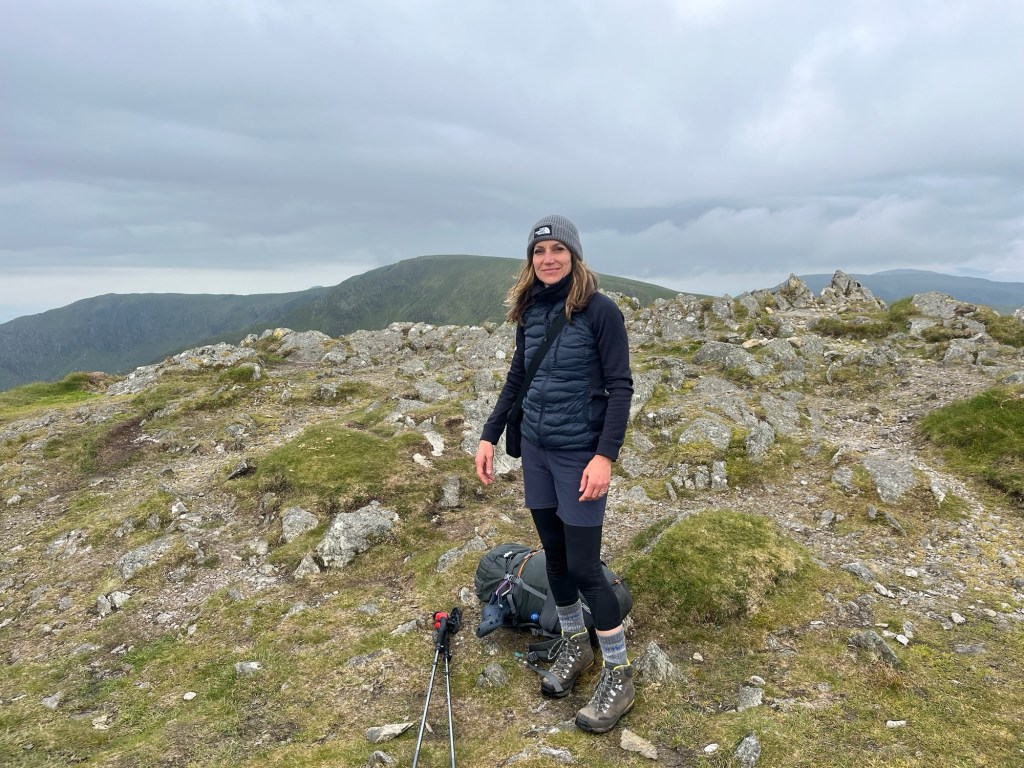
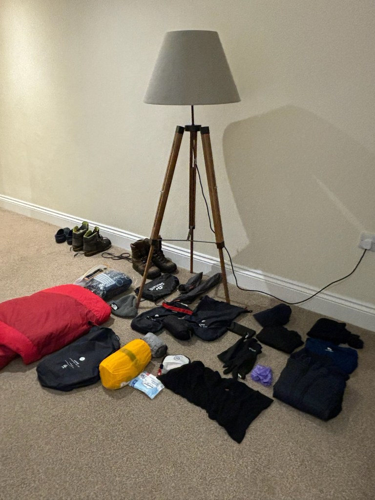
We had been splashing out in the wonderful outdoor shop, Alpkit, in Ilkley and felt we were well set up. We had a lightweight tent, very light sleeping „quilts“, lightweight stove, new rucksacks and reasonably comfy lightweight air mattresses. We‘d decided not to buy new boots but use the walking boots which we were both used to. Lots of merino clothing was hastily purchased (it doesn‘t smell after a few days – or so we were told) and we were ready to go. Our packs weighed just under 10kg including food and water, which was what my friend Graham had told me was a good target to aim for. We felt well prepared and, to be honest, pretty smug.
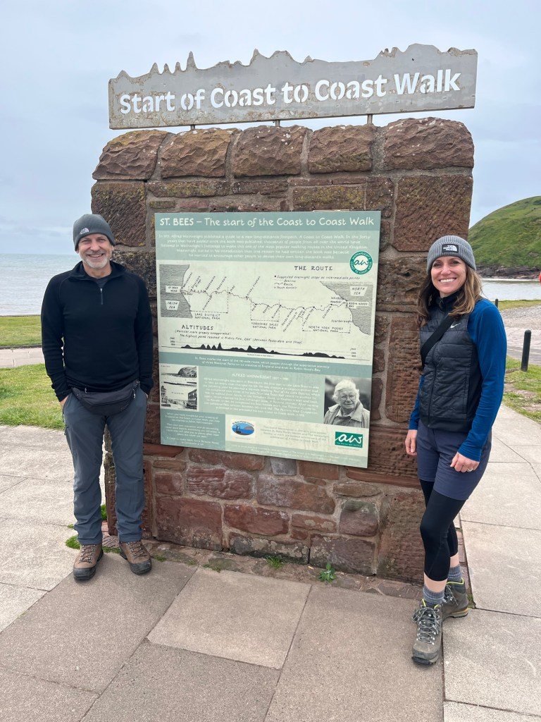
My brother, Rob, kindly drove us from Wetherby (where we‘d just celebrated Mum‘s 90th birthday in style with Fish and Chips) up to the start point in St Bees. As we were so keen to get going we ended up arriving there just after lunch, but hadn’t planned to actually set off until the next day. It was a bit grey, quite windy and surprisingly cold. A few days earlier, I had seen Ariane packing her woolly hat and commented that she shouldn‘t waste space with that – it‘s June! She convinced me otherwise and I packed mine. And even before we set off it came in useful. I grabbed my woolly hat and headed down to the seafront.
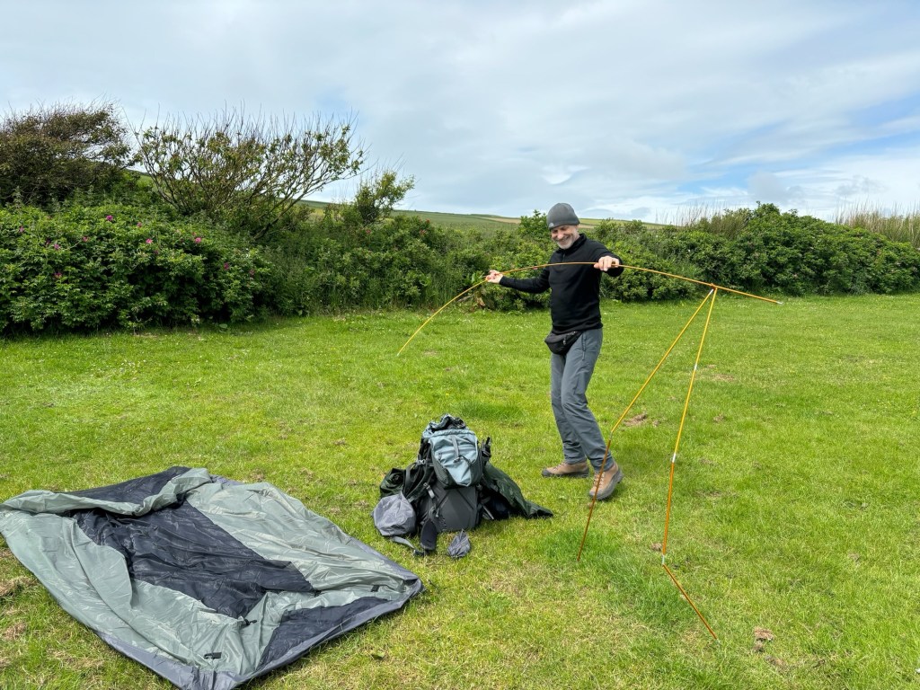
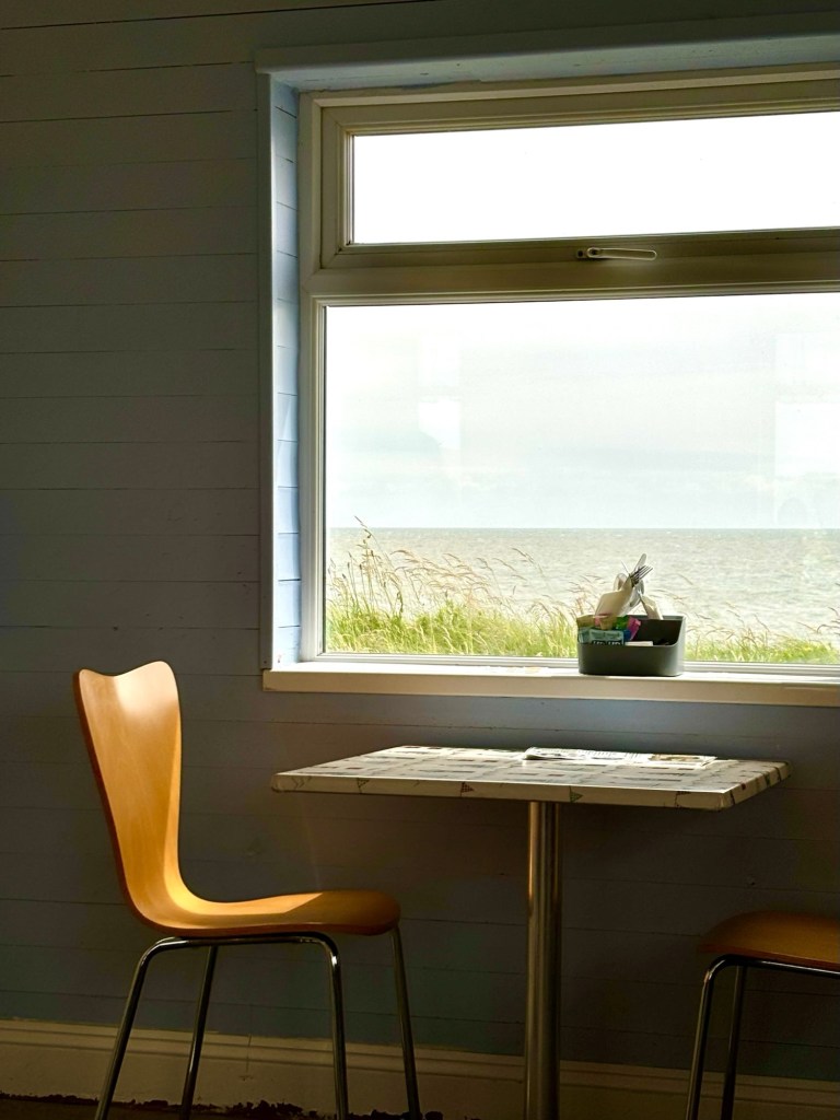
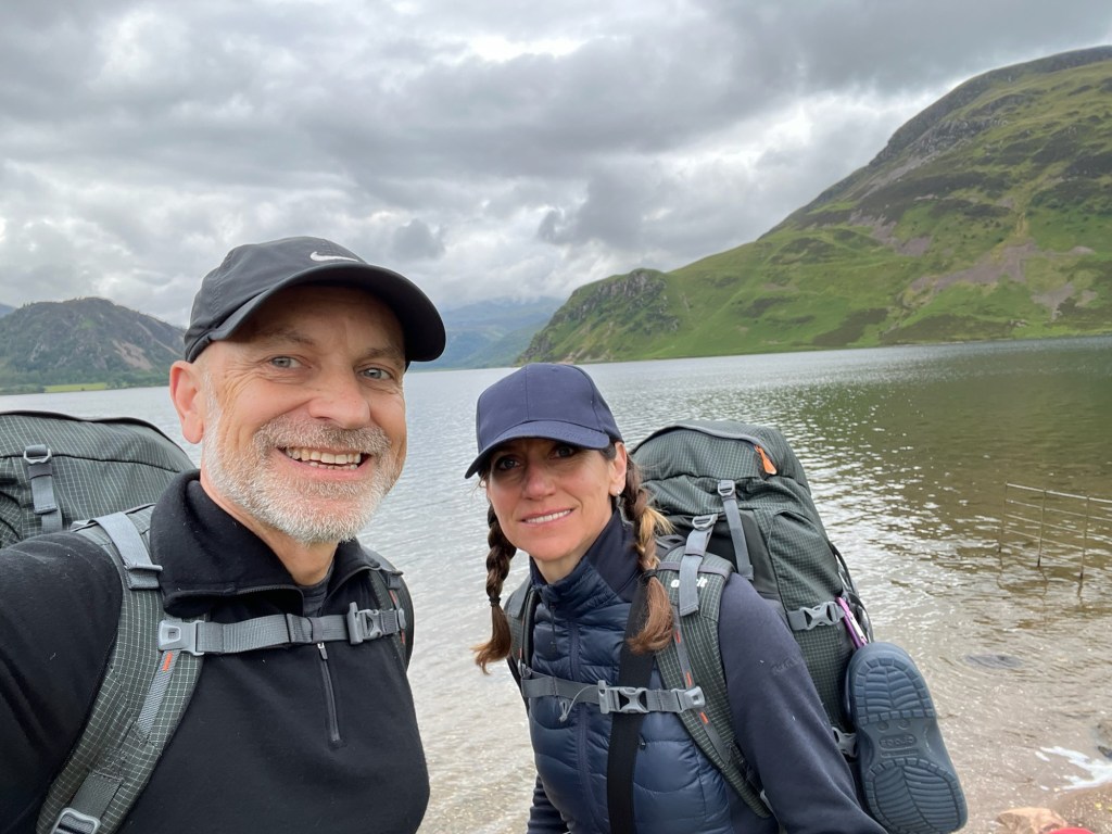
Rob took a photo of us stood next to the sign signifying the start of the walk, and then left us to start our adventure. We checked in at the campsite which was mainly static caravans and plodded to the camping field. We were the only occupants. We set our gear up reasonably quickly, zipped up the tent and wandered around St Bees. We had some lunch in the café on the front, which had a strange 1950s vibe, wandered around the village of St Bees and took a small walk up the coast. Some time in the afternoon it started raining and didn‘t stop. I found St Bees village to be a little depressing, as I do lots of English seaside resorts that have probably seen better days. We didn‘t care. Later on we set up our new cooking stove and boiled water for a dinner of Pot Noodles in the dry laundry room. I hadn‘t had Pot Noodles for decades and can still remember the hype when they came out in the 1980s. I had imagined that the food technicians would have improved them over the intervening decades. Turns out I was wrong – they tasted terrible, the peak of ultra-processed rubbish and they gave me quite spectacular wind. Not the best side-effect when you are embarking on a fortnight sharing a tiny tent with your wife. I hoped the wind and rain on the tent might somehow disguise things. I also had a vague feeling of constipation which would stay with me for a few days.
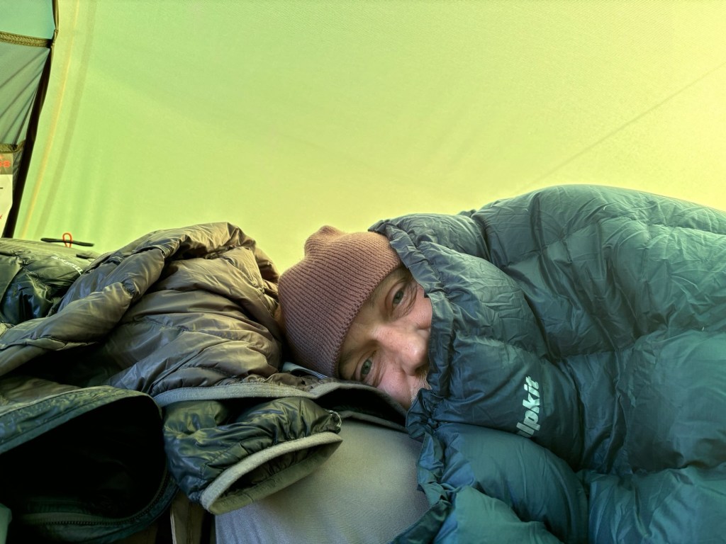
Eventually we ran to the tent, got under our lightweight quilts (recommended by expert long-distance walker Christine Thürmer) and lay down to sleep. The wind was strong and the rain battered our tent until the early hours. Usually, this wouldn‘t bother me because I enjoy the feeling of being tucked up warm when the weather is raging outside, but that night was different. Our smugness disappeared when we realised we should have bought warm sleeping bags with us. We both ended up with most of our clothes on as well as our woolly hats and probably had no more than 3 hours of sleep. But as I couldn‘t sleep, I googled around and saw that up the road in Whitehaven there was a Millet‘s outdoor shop so we made a plan to walk an extra 3km there and an extra 3km back and buy sleeping bags.
Luckily for us, the rain stopped before dawn and when we popped our heads out of the tent in the morning we were greeted by clear blue skies. We packed up and were out very early. Finally, the adventure had started.
Day 1 – St Bees to Ennerdale Bridge 31.35km
Tradition dictates that you collect a pebble from the beach at St Bees and throw it into the sea at Robin Hoods Bay upon completing the walk. You are also supposed to dip your (boot) toe into the sea at both ends. We had collected our pebbles and dipped our boots the day before so we could immediately set off on the coastal path without wasting any time. Shortly after 7am we had packed up our gear and were on our way.
It was sunny, but still cold and windy so the woolly hats were in use. My weather app told me that the previous night‘s temperature was just 6 degrees – adding in the rain and wind-chill effect it was no wonder we were cold.
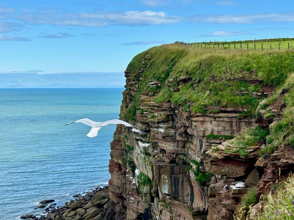
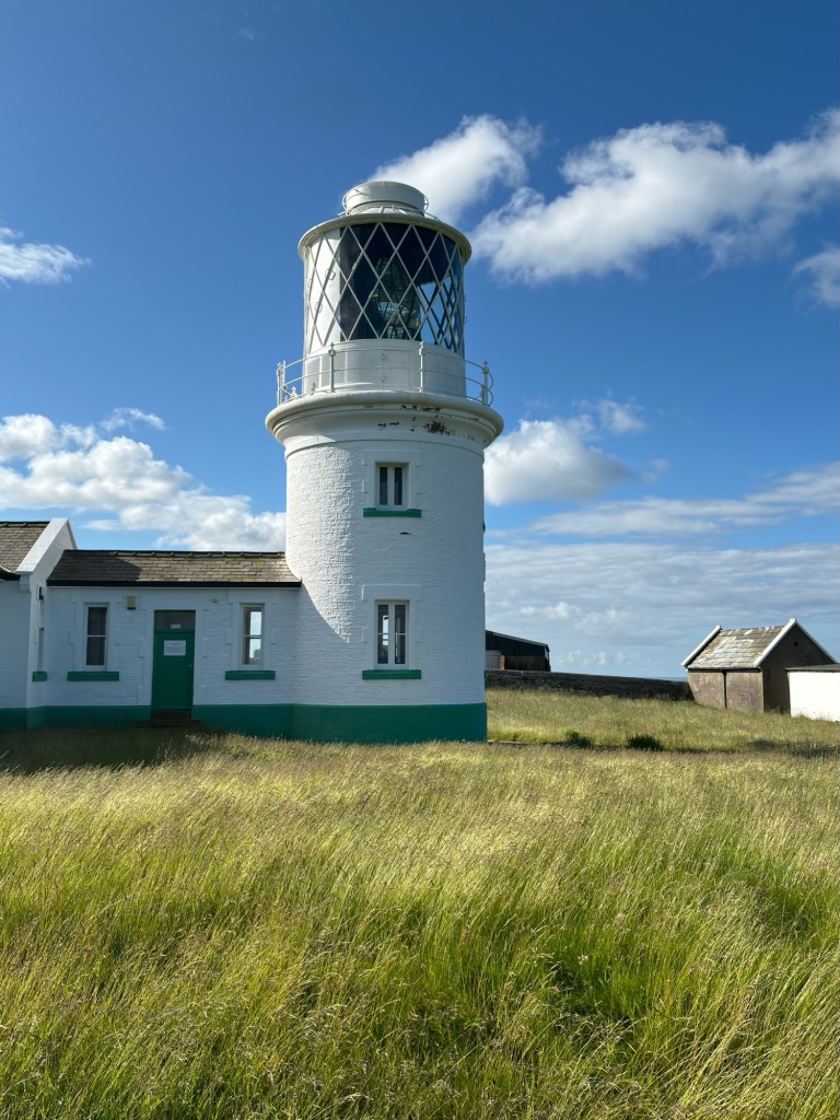
But now all the worries were behind us and we enjoyed the views of the sea cliffs, teeming with birds and could even see the Isle of Man out in the distance. We made quick time to the first real landmark, the lighthouse and St Bees head, and rewarded ourselves with a breakfast of porridge cooked on our „Brukit“ gas stove. I also took the opportunity to dry out our tent which was still damp as we had packed it away hurriedly that morning. We felt good. We had used some water, eaten some food and dried the tent. Our packs were a little lighter so we could head up to Whitehaven for those sleeping bags.
The diversion was only 3km each way, but it was a dull trudge along roads and through a surprisingly large built up area. We found Millet‘s and bought the 2 most compact sleeping bags they had. We reckoned that combined with our quilts, this would be enough to keep us warm. They took up more valuable space in our packs, but this seemed like the best solution. We crammed everything into the bags in the pedestrian zone and decided to have an early brunch in Whitehaven. We ordered hot sandwiches at a pleasant café and were just starting to eat, when a scruffy looking man appeared around the corner and said „Welcome to the shit-‘ole“ in a London accent. He repeated this mantra continuously as he shuffled past us into the main shopping street. I smiled at Ariane and said „welcome to Whitehaven.“
Our final task, before leaving Whitehaven was to go to the cashpoint. We didn’t have any cash on us and thought an emergency supply would be a good idea. We trudged out of the town and along the main road which would eventually get us back on course. Ariane saw a small retail park with a Morrison‘s supermarket attached down to our right. I said we should press on and didn‘t think there would be a cash machine there. When you are fully loaded up and keen to get on, you don‘t want to waste five minutes walking around on a wild goose chase. But Ariane prevailed, so we walked down the hill and crossed the huge carpark and eventually did find a cash machine. Freshly stocked up with cash, we trekked back up the hill and I felt for the first time that we were really on our way. All in all, that diversion took us no more than ten minutes but I was so keen to press on that it seemed like a major undertaking.
200 hundred yards further on, we passed a petrol station which was right on the road and had a cashpoint. But how could we have known? Well, it was in fact the petrol station we had stopped at a day earlier to fill up. And as I was navigating and saying, „this is the road we drove down yesterday“, I suppose I could have known. I kept quiet and trudged on. We made good time along the roads and by 1 pm we rejoined the trail and took photos by the statue of Alfred Wainwright, the famous Cumbrian author and fellwalker who created the route.
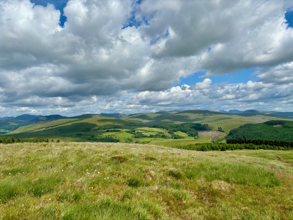
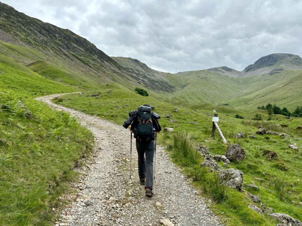
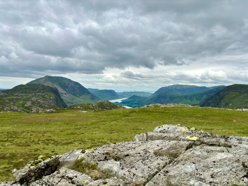
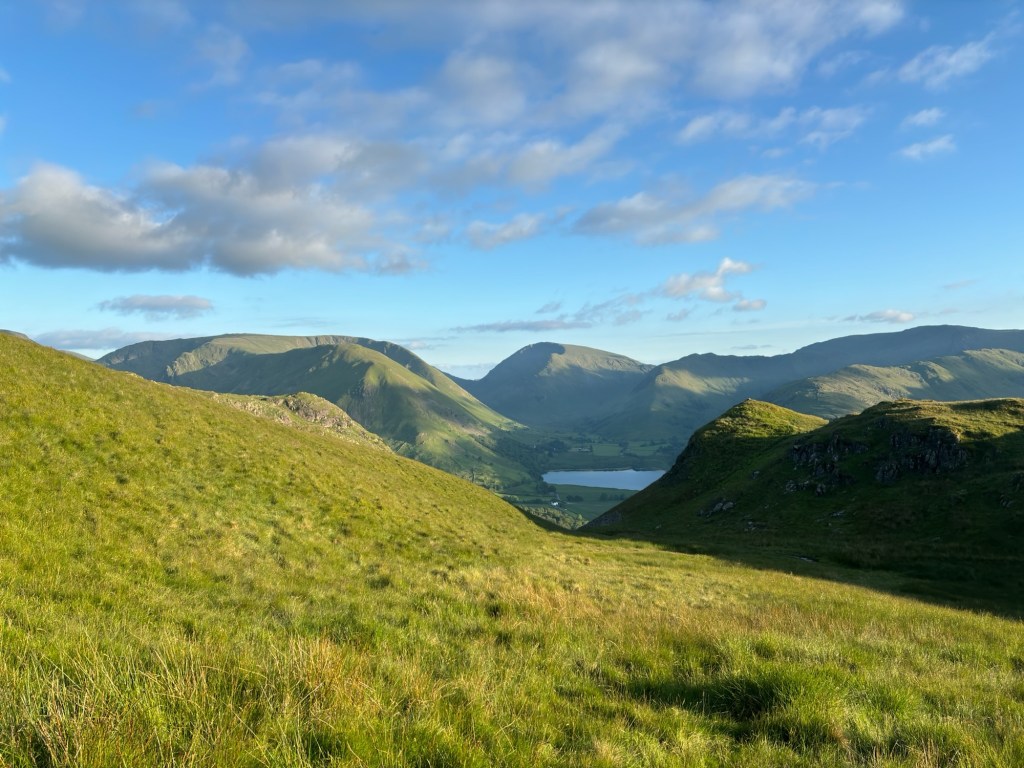
We had done a loop up and down the coastline but now we were heading straight inland and could see the hills of the Lake District which we‘d be crossing in the next days. An hour later we had left roads, towns and villages and were following a wooded track up Dent Fell, the first climb of the walk. It was perfect walking weather. Sunny, but cool. We crossed a little footbridge over a clear mountain stream and the path started to steepen. After a little while we passed through what looked like a recently abandoned farmyard, and were plunged into a different world for a minute or so. One minute we were on a shady path, and then suddenly we popped out of the woods and the trail skirted around this farm. We walked past a skip which was overflowing with burnt tin cans. There were rusty bikes, a few cars and tractors stood around rotting in the weeds. It was the perfect setting for the climax to a horror film. The uneasy feeling was short-lived, however, and we were soon through the next gate and heading through the forest to Dent Fell. After a few minutes, we were through the trees and onto open moorland on the top of the hill. The views were magnificent so we had a drink, a short rest and took some photos. It was early afternoon and more or less all downhill to our first stop.
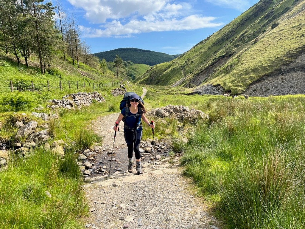
We continued over the hill on a good path and then had a steep descent through some woods. I was navigating using only a map-book and had seen that there were not many signs on the route. It was surprisingly easy to miss a turning and get off track. We also learned that going down steep hills with a rucksack on your back is hard work. Still, we soon emerged into a picturesque little valley and followed the path alongside a small river. By this time our feet were hot and tired so we took our boots off and had a paddle in the very cold Cumbrian water. After we‘d dried our feet and put our boots on we felt much better. We‘d use the „cold stream foot therapy“ quite often in the coming days.
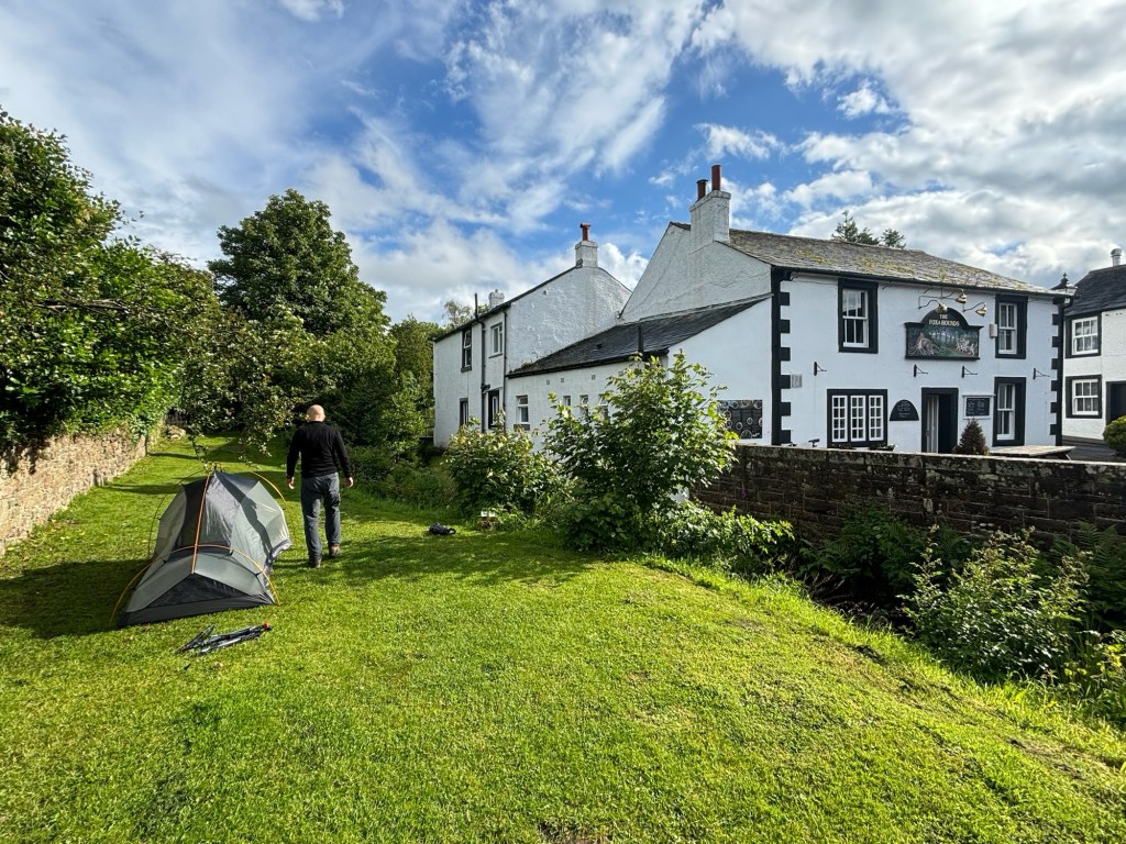
20 minutes later, I wasn‘t quite so cheerful. We were getting soaked in a rain/hailstorm and I wasn’t sure that we were still on track. We slogged on and soon came to a road which I found on the map and realised we weren‘t far away from our goal for the day – the Fox & Hounds pub at Ennerdale Bridge. We raced along the road and walked, dripping-wet into the pub with a great sense of relief.
Once we‘d hung our wet jackets and gear over the chairs and had drunk our first pint, we felt much better. The shower had passed and we set up the tent in the beer garden directly behind the pub. Then it was time for a pub-dinner and a chat to some fellow „coast-to-coasters“. We hadn‘t seen anybody en route all day, but there were a few at our first stop. We also met two friendly local gentlemen who gave us a tip for the next day. We shouldn‘t take the normal path to the „right“ of Ennerdale water because it was very treacherous. One of the guys explained how difficult the path was while acting out various climbing moves. I had read that the route on the other side of the lake was easier and had decided to take it anyway. I nodded wisely and said that we would heed their advice and take the route to the North. „No“, he said, „take the route to the left.“ As the route to the left was the one to the North I deduced that these two merry locals weren‘t perhaps the wizzened mountain-men I‘d originally taken them for. After they‘d had another 4 pints each and re-enacted the climbing movements necessary on the difficult path at least another dozen times, I was happy to see them go. They did suggest we might like to try the other pub in the village, where they were going on to. I said we‘d see and perhaps bump into them later. We paid and headed for the tent. We slept well.
Day 2 – Ennerdale Bridge to Borrowdale 28.65km
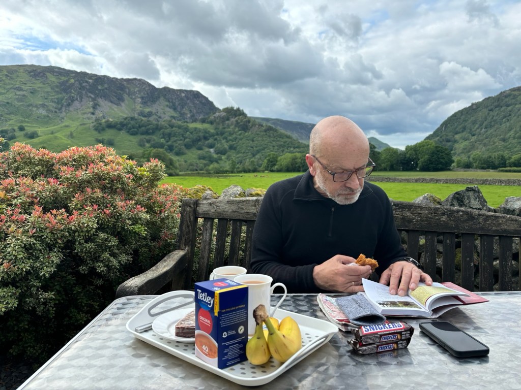
We woke up to cloudy skies but no rain. The pub opened their doors at 7am so we could get washed and fill our water bottles, and we also took the chance to have a quick bacon roll and a cup of coffee, before setting off on our first proper day in the Lake District. The first half of the walk would be quite straightforward and flat, followed by a big climb over to Honister pass before dropping into the pretty valley of Borrowdale.
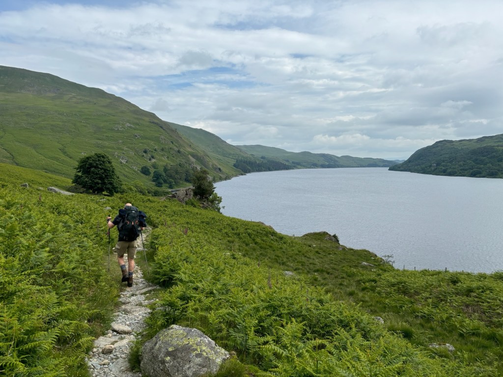
We set off on flat tracks to Ennerdale water and, as advised, took the flat route along the North edge. The sky was grey, but the views of the lakeland mountains were nevertheless spectacular. At the end of the lake, the sun came out so we stopped at a bridge for a drink and took out our tent to dry over a fence. We were soon joined by a group of about 15 walkers with a guide. We learned that they were staying in hotels and pubs and had a luggage-transfer service to transport most of their gear. We packed up and ended up setting off at roughly the same time. I was keen not to go too fast, this early in the walk, and soon the group overtook us and disappeared into the distance.
I should say, that the main purpose of the walk is to enjoy it. Petty competitive feelings about someone else being faster than you have no place on the Coast to Coast walk. The others only had light daypacks and of course they were faster than us. Still, without talking to each other, I sensed a vague disappointment in Ariane that we were the ones being overtaken.
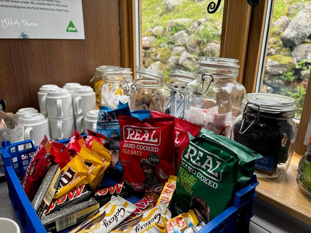
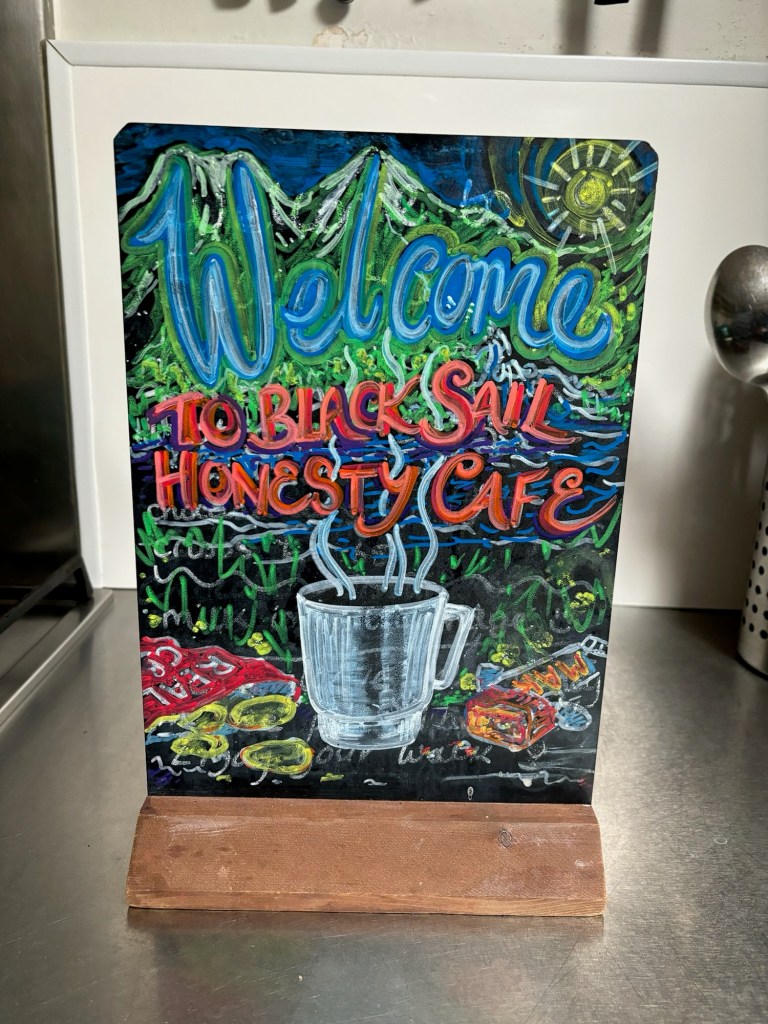
Time passes more quickly than you realise on these walks, and as we started up the gentle climb to the Black Sail youth hostel, we began to feel a bit hungry. Ariane definitely wanted to eat something before tackling the steep climb over to Honister. We didn‘t have much with us as I knew there was a café later on, but I needn‘t have worried because at Black Sail there was an „Honesty Café“. We were to encounter these at several locations over the next few days. In the hostel we found snacks, some fruit as well as hot and cold drinks. There is a price list and you just leave cash in the box for what you take. We both had a strong cup of tea and a couple of chocolate bars. The group were all gathered there too and set off up the hill as we arrived.
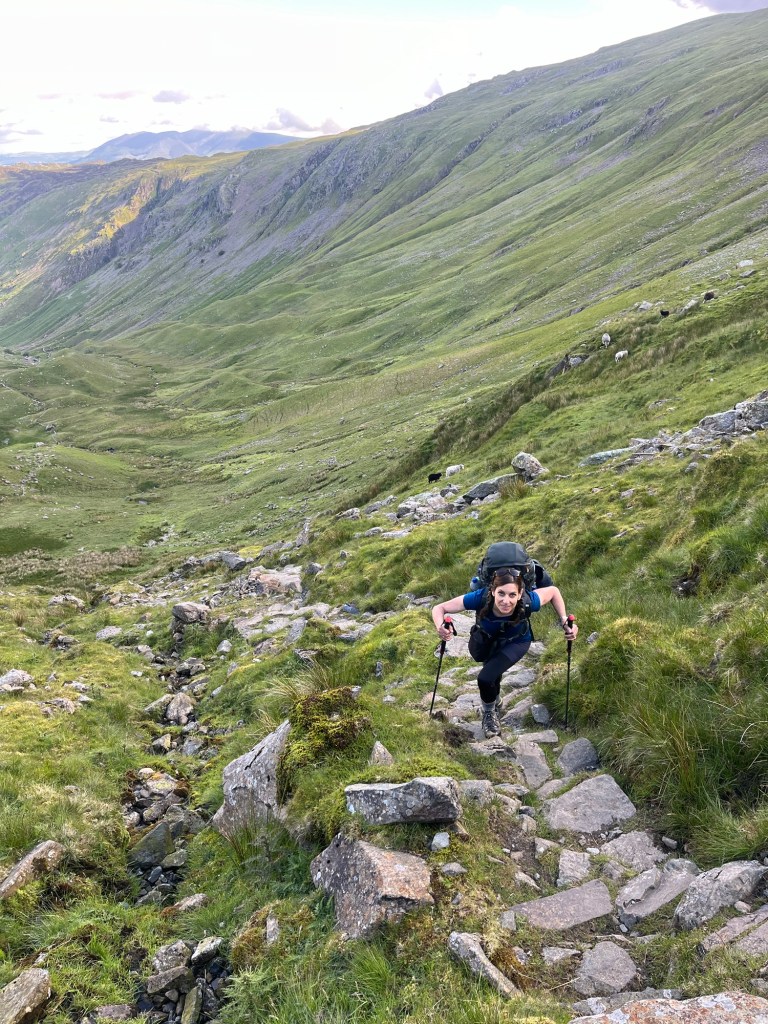
Fortified with tea and sugar, we set off shortly after them. At first I was out front and I set a very slow pace. We were carrying 10kg and had 4-500m elevation in front of us. At the bottom of the steepest section, Ariane pushed past me and set a much faster pace. Before long I was sweating hard and we were catching people up. The click-clack of our sticks on the rocky path were a warning sign to step aside. I could just keep up, but it was hard work. But Ariane felt good and had fired up her legendary „diesel motor“ which once activated can go on all day. By the time we reached the top and had a rest, we had caught the big group. We then managed to pass them going down to the café at Honister pass and I was happy to get in before them and buy the last 2 pasties.
As I wrote above, there is no point in treating a walk as a competition. In fact it defeats the purpose to some extent. But old habits die hard and we were still shaking off the remnants of the ratrace. We both felt better having „burned off“ a group of tourists. Some of them were even wearing trainers and had no business overtaking us. Bloody cheek. We showed them.
We were soon heading downhill into Borrowdale and the village of Rosthwaite. Here our good luck continued as we found a little tea room which was going to close in 5 minutes. We were tired out and our feet were really hurting, so we ordered tea, cake and flapjacks before sitting out in the sun to watch a robin and some sparrows pick the crumbs. We also took off our boots and socks and gave our feet some much needed fresh air.
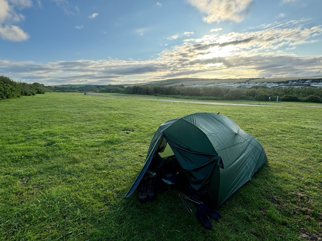
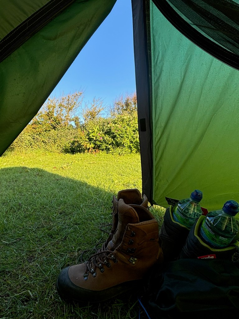
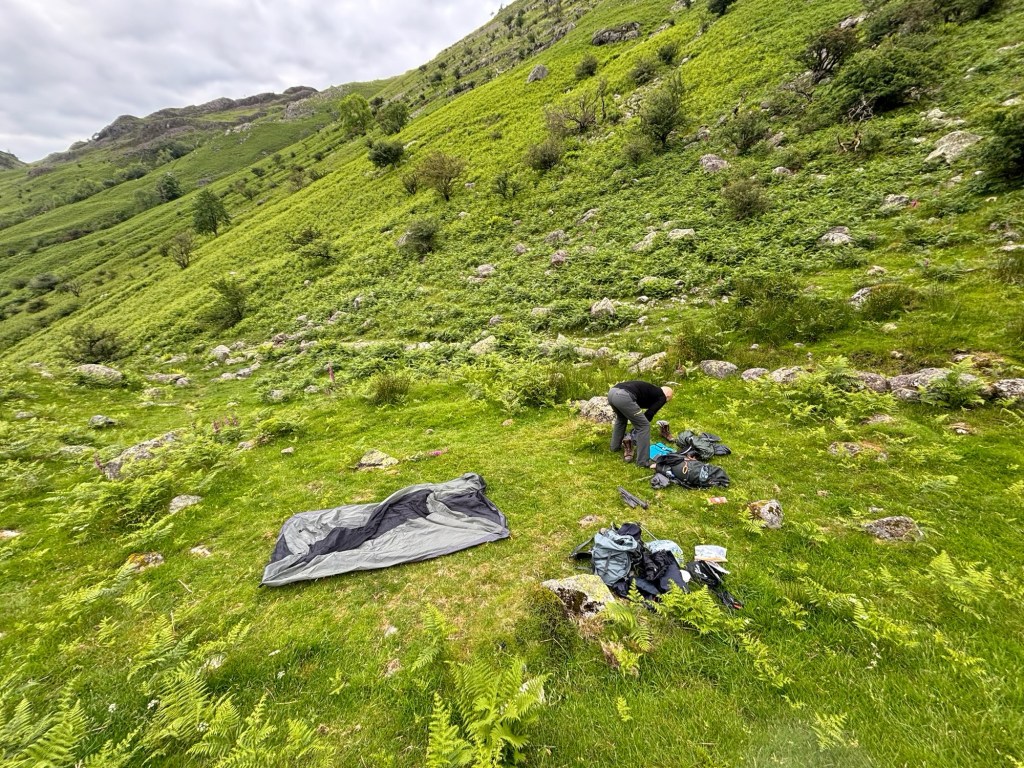
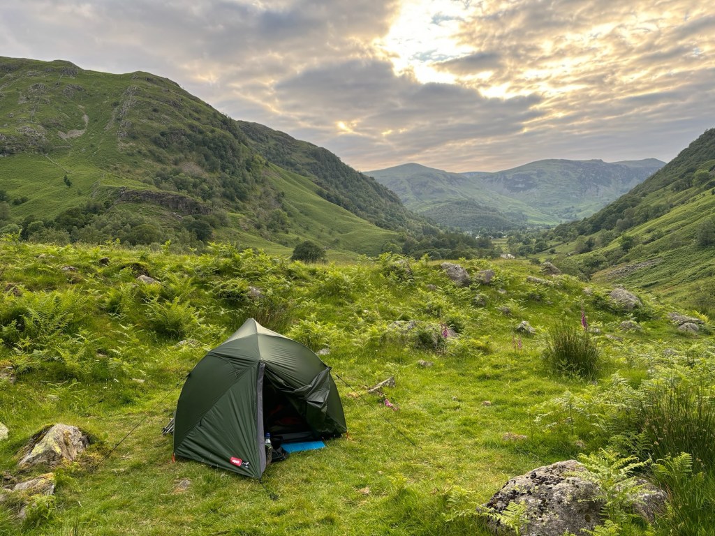
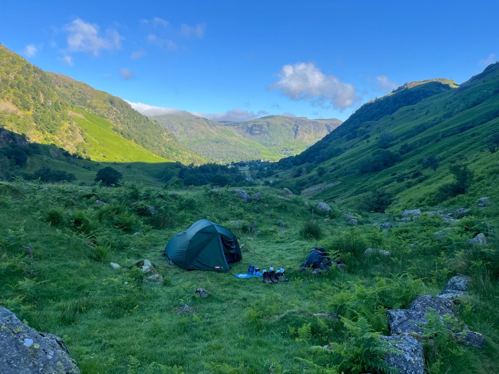
Our plan was to walk on a little and find a spot to „wild camp“ on the way out of Borrowdale. This would knock some distance off the next day and we also really wanted to be on our own in hills when the weather was so good. We were both surprised to discover that we felt surprisingly strong after our tearoom stop. The first few steps were hard, but soon we were both yomping along the valley, keeping an eye out for a flat spot to camp. After an hour of walking, we found a little plateau with wonderful views and enough space to pitch our tent. It was now about 7pm and nobody else was on the fells. We pitched the tent and set about cooking our dinner. We had been dreaming about wild camping for months now, and for once it was just as good as we had hoped.
Our dinner was special camping food – just add boiling water, wait 10 minutes and you have a lovely portion of Barley Lentils which you can even eat from the bag. Because weight and volume were so important to us, we had no plates or bowls. The lentils didn‘t taste great, but gave us the calories we needed. The dinner, on top of yesterday‘s Pot Noodle was perhaps not the best choice and my digestive tract spent most of the next day reminding us of that fact.
We went to bed at about 9pm and were warm enough. We both slept soundly, which was good because we knew there was a big day ahead of us.
Day 3 – Borrowdale to Angle Tarn 28.86km
At this time of year, the nights are very short in Northern England. It didn‘t get dark until 11pm and it starts getting light before 4am with the actual sunrise at about 4:30. As a result, it was easy for us to get up and get going early. We had two long climbs to make the official goal in Patterdale, but we now had a taste for camping wild and wanted to carry on walking late in the evening before stopping at the very photogenic Angle Tarn.
The weather was good, a mixture of sun and clouds, and we felt good setting out early and having already done about 2 miles of the day‘s walk yesterday evening. We were soon heading up to Greenup Common on the way to Grasmere. It was a steady climb along good a good path until the final section which was so steep as to become a „scramble“ (which means we needed to use our hands to pull us up some sections). The views were all the better because we were really on our own and didn‘t see anyone else until we dropped down into Grasmere – one of the Lake District‘s major tourist centres. It was strange suddenly seeing people in jeans and fashionable jackets with little dogs on leads. Still, we were tired and hungry and very pleased to see Emma‘s Deli at the start of the town and settled down for a large early lunch.
After lunch and refilling our water bottles, we walked over to Cotswold Camping to stock up on some urgent supplies. I bought a compass and we also got some dried müsli meals for breakfast the next day. The man in the shop asked, somewhat wearily, where we‘d come from and I said Borrowdale. He asked where we were going and I said Angle Tarn. As soon as he realised we were camping and carrying all our own gear, his demeanour changed and he couldn‘t be friendly enough. This mini ego-massage helped us before the next ascent.
We were soon making our way out of Grasmere, along a couple of roads (always unpleasant because they are so narrow in the Lake District and there is usually no footpath) before joining the grassy path which would take us over past Grisedale Tarn and into Patterdale. It was a long hard slog but we made our way up, with only one minor incident. As we got quite close to the top, another walker joined the trail just above us. He‘d come across a hillside from another direction and was waiting for his wife who was a few yards behind. We said hello and continued upward. I had assumed he would wait there for a while and was a long way out of earshot when I released some of the lentil build-up which was fighting to get out. It made quite a noise. Ariane thanked me sarcastically for that and pointed out that the chap was right behind us.
He had the annoying habit of dropping back and then accelerating to catch up to us. He did this five or six times over the rest of the climb and I think it was because he wanted to show us that he was fit and fast. I thought this was a bit pathetic… until I remembered our racing episode from the day before.
It turns out he was a very amiable Scot who had given his wife a walking weekend in the Lakes as a 30th anniversary present. He was having trouble navigating with no phone reception up there. As he had promised his wife that their walk wouldn‘t be too hilly and they were now 500m above their starting point, he was under some pressure to find the right way down. We had a look at maps and agreed on the path to take. It all worked out as we saw them again down in the valley as we bathed our feet in a cold stream.
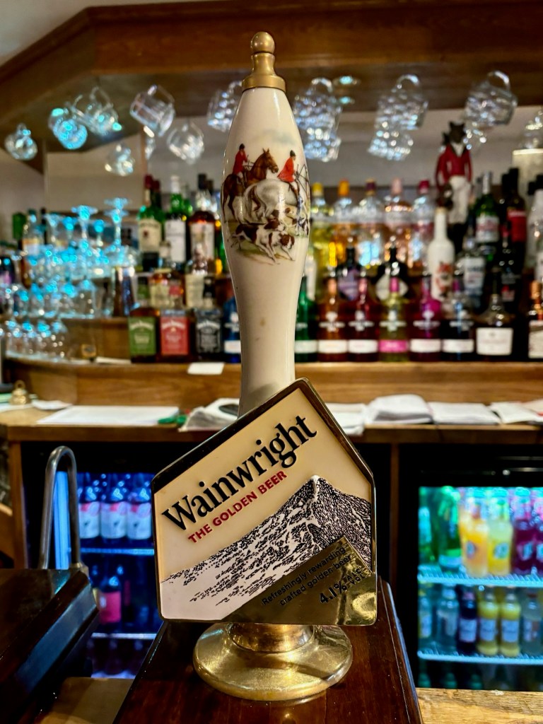
By about 6pm we had reached the official end of the stage in the village of Patterdale. We found a great pub which had everything we needed: charging points for our phones, good food, good beer (Wainwright Gold) and a very friendly barman. We re-charged, fed ourselves and headed off on the final stretch to get up to the famous wild-camping spot, Angle Tarn, which was about an hour‘s uphill walk.
We felt surprisingly strong after our pub dinner and hit the hill in cool evening sunshine. It was perfect walking weather and the views in the evening sun were breathtaking. A couple of lads that we‘d seen on day one overtook us, but we didn‘t mind because they were (a) young and (b) looked like „proper“ backpackers. They were heading for Angle Tarn too and soon disappeared up the trail in front of us.
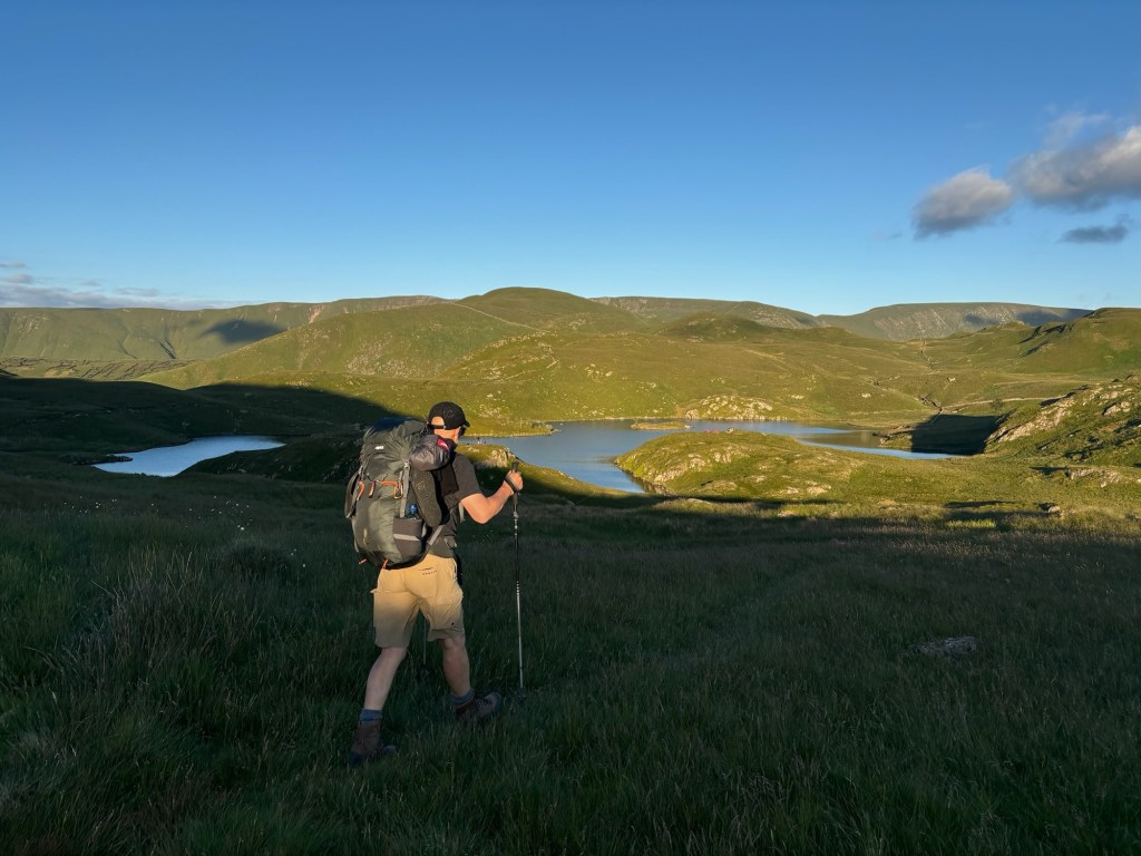
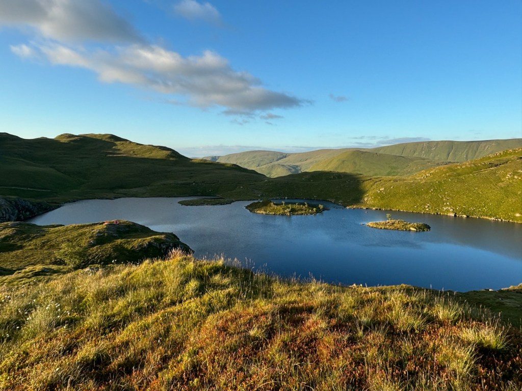
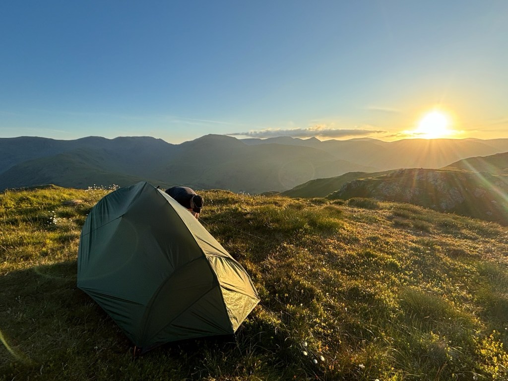
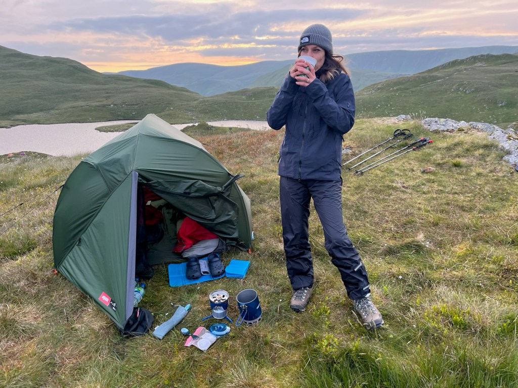
After an hour of energetic climbing we reached the spot. Around the tarn were various grassy knolls, upon which a couple of tents were already perched. The two best spots near the Tarn were taken, but we found a slightly higher hill which had great views to the West for sunset and the East for sunrise. It was windy and quite cool but good weather for camping. We set up our gear and took photos of the sunset, before bedding down for an early night. Tomorrow would be our last day in the Lakes with one high peak which I wanted to clear before the bad weather which was forecast came in.
Day 4 – Angle Tarn to Shap 25.42km
Whenever we had phone reception, I had been checking the weather forecast. For today it looked bad – heavy rain starting late morning and not stopping for at least 12 hours. With this in mind, I had managed to book us a hotel room in Shap as I didn‘t fancy setting up a tent in the pouring rain, when all our clothes were wet anyway. According to my guide book, we had one moderate climb up to Kidsty Pike and then an easy walk down to and then along the edge of Haweswater Reservoir, then over some rolling fields to Shap. As we had already done a fair bit of the first climb yesterday evening, I expected an easy day. I was wrong.
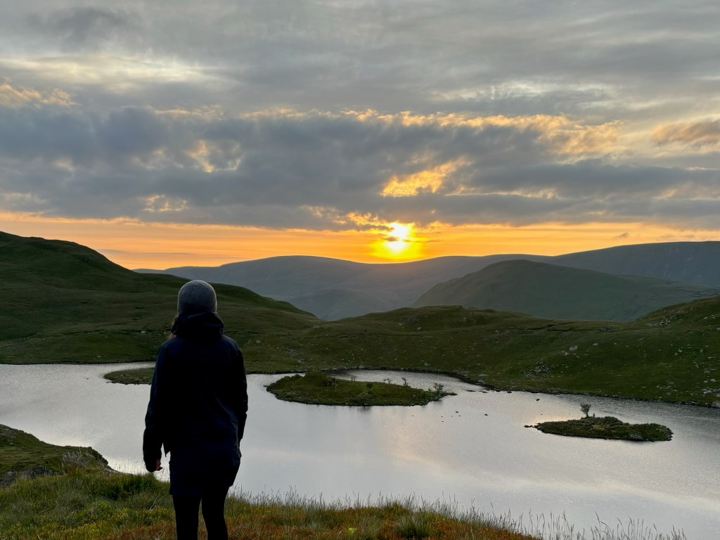
We were up early to see the sunrise over Angle Tarn before 5am, had a quick breakfast and were already walking by 6am. It felt good to be ahead of schedule and even though the sky looked quite foreboding to the West, I thought we could get over Kidsty Pike before the rain came in. I was navigating using an Ordnance Survey map book and had to be careful. It was nice to dust off my old map-reading skills but the paths were not marked and not clear up on the tops and I had to concentrate to stay on track – and that was with good visibility. If cloud came in, I was really worried about finding the way.
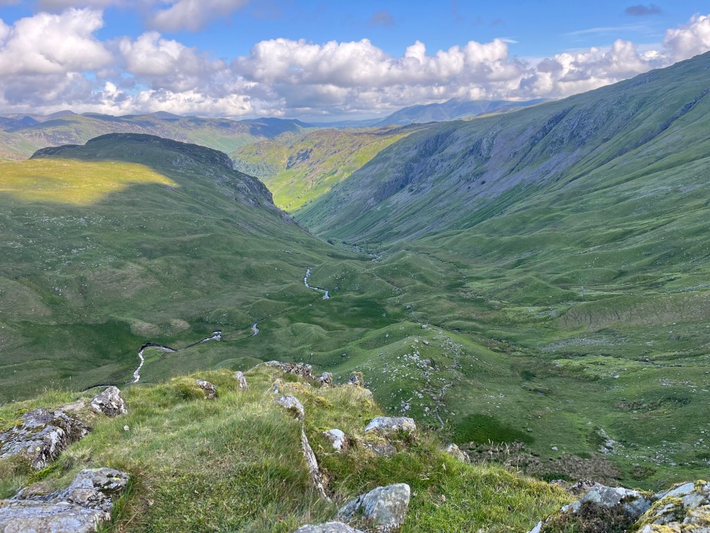
Still, we made good progress and were on top of a cold and windy Kidsty Pike before 9am. This was the highest point of our walk and the views were spectacular. But we were anxious to get down and had already had our fill of Cumbrian mountain views. The initial descent was gentle, along a soft grassy ridge. Then we found ourselves on a nasty, rocky steep descent. When you are a bit tired, your knees are no longer as supple as they were and you are carrying a 10kg rucksack, then going steep downhill is a slow form of torture. We worked our way down, bit by bit. To compound our misery, Ariane‘s left boot was giving her some ankle trouble so she had to stop and adjust it a few times. We were at least looking forward to a gentle stroll along the reservoir when we got down.
But there was our next surprise. My assumption that the path would be flat and easy going so we could make good progress away from the rain, proved to be wildly optimistic. My guide book said only that the path was „obvious“. We soon found out that it was easy to follow – but horrible. Constantly climbing and falling, very narrow and littered with sharp rocks. We made more slow progress and our legs were hurting. Finally, after 6km and probably 2 hours of walking, we reached the dam at the end of the reservoir and followed a path through the woods with about 6km to go until Shap. For a short while, we really enjoyed it. We were walking on meadows, not sharp rocks, and made good progress for a kilometre or so. Then came the rain – heavy and constant.
We put on waterproofs and plodded grimly on. Now we just wanted to get there and every gate or stile was just an irritation and not a chance to appreciate the view. At this stage, I took a wrong turn and we probably did about 400m before I realised. I was annoyed with myself and angry with the world for not putting better signs on the route! I plodded ahead and whacked a couple of thistles with one of my sticks. I did have my eye on a beautiful lone foxglove flower, but resisted the temptation. Ariane kept quiet.
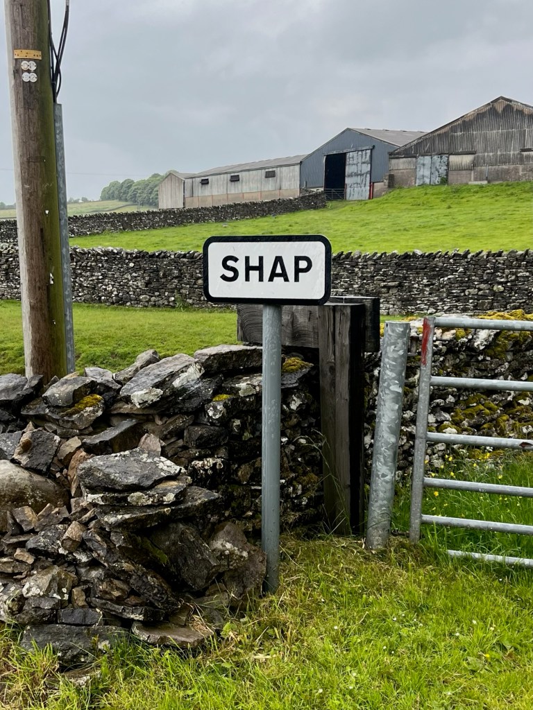
The navigation was fiddly, with lots of gates, tracks and turnings to get right and stopping in the rain to look at the map is never much fun. I went slightly wrong a couple of times but eventually, after 9 hours of walking, we got to Shap. Unfortunately, we entered the town from the North and our Pub/Hotel was 1.5km away at the South end. Shap is a grim place (the joke being it was named by combining the words shit and crap) at the best of times, but in this weather it was awful. We trudged down the main road, spurred on by the pull of a dry bed.
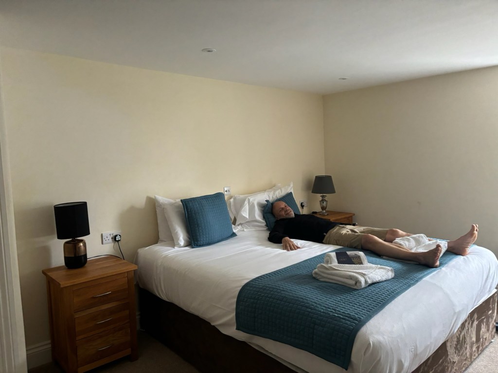
It was such a pleasure to walk into the The Greyhound Pub and be greeted by a very friendly barman who immediately found my reservation. We took off our waterproofs and soaked boots and suddenly felt so good that we each had a pint of beer before checking in. After that, we gathered our gear together and struggled up the stairs to check out our quarters.
To us, it was pure luxury. A comfy bed and lots of space to lay out and dry our gear. Dinner and breakfast were booked so with nothing more to worry about I had a long hot shower and then fell asleep for an hour or so, taking pleasure in hearing the rain against the window while being warm and dry.
I woke up before dinner and took stock of our journey so far. We had put the Lake District, with (on paper) the hardest days behind us. We had had two wonderful wild camps and we had been rained on twice but managed to dry out quickly afterwards. I was definitely ready for a change of scenery and we looked forward to the green fields of the Yorkshire Dales laying before us. Kidsty Pike and Haweswater Reservoir were no fun, but I felt that I had left an appropriate mark on the slopes of that final mountain – now hidden under a few stones. My constipation and wind problems all solved in a few glorious seconds.
To be continued… Part 2 covers our next 4 days through the Yorkshire Dales and is less concerned with my digestive problems.
The distances shown were measured on my Garmin watch. They are always a little further than the official route because it counts my navigation errors and general faffing about too.

Very enjoyab
Just read it on a large-ish screen — I had previously scanned it on my phone. A lovely read; Roll on section 2.